I was asked by the new owners of a DeFever 52 Pilothouse Trawler to work with them as they transition into their new larger boat. We accomplished this and so much more while relocating this terrific trawler from Annapolis to Charleston, SC. Get a cup of coffee and settle in to travel along with us on this wonderful adventure…don’t forget to look at the photos too…at the verrrrrrry end of this article!
Mid November is crispy and cool but this year we had strong Northerly blows in the Chesapeake Bay which made our cruise south exciting. Following seas in the 5 to 7 foot neighborhood and occasional larger surprise waves kept us on our toes the entire first day out.
The autopilot was overworked so we had to steer by hand with proactive steering before the stern wave moved the boat in a different direction. Did I mention this boat does NOT have stabilizers? Despite that, she rode well but we needed to steer by hand to predict the stern wave action on the boat.
As darkness approached we wisely headed into Deltaville, VA anchorage in Fishing Bay. As we anchored in the lee of the land we hear a few boats chatting it up on the VHF so we listen , both to learn and maybe even to be entertained! What a great surprise to hear friends aboard their 52 foot steel trawler Vector. They are in Jackson Creek in the Deltaville Marina waiting on parts to arrive by truck. Small world. We often remark that our cruising world occupies thousands of miles long by 1/2 mile wide.
We listen to the weather, watch local TV meteorologists and search the NOAA Weather sites on the internet trying to convince ourselves tomorrow will be a better day. No luck as Gale Force winds are predicted for the Hampton Roads, Norfolk area. Remembering that a schedule is a dangerous thing to have on a boat, we decide to sleep in and wait out the weather.
NOAA IS WRONG???
Rise and shine to the heavy winds just as forecasted so we do a little trip planning , poke around the new-to them boat and sit around listening to the VHF. And yes, being nosy pays off. A 45 foot sailboat is leaving Jackson Creek headed south so we chat him up and agree to radio him every hour for a weather update. It works! The sailboat reports that the weather is improving. His perspective is appreciated because he was out there yesterday with us. He also has a 7 foot keel and sail rigged for heavy weather.
As he nears Wolf Trap he reports 2 to 3 foot seas and 10 to 15 knot winds. Very doable for us. This is at 11 AM and we hurriedly weigh our anchor so we can get into the Bay and head South into Norfolk. The sea state was exactly as he said and we were happy to be moving again.
Hours later as we round Thimble Shoals Lighthouse we hear the Coast Guard continue their unwelcome announcement: the Great Bridge Lock on the ICW continues to have problems and the lock will be out of service for an unknown period of time.
On to Plan B. What do we do now? While we are on a training delivery it is too rough to head out into the ocean and go around Cape Hatteras. If this was strictly a pleasure cruise we might consider exploring some of the museums in Norfolk while waiting for the weather to improve. But as this is a training delivery we do need to make some progress. So, we choose the lesser traveled Dismal Swamp Route. This is an alternative to the usual Virginia Cut where the Atlantic ICW passes through Great Bridge, VA and the now broken down out-of-service Great Bridge Lock.
As we loose daylight we are delayed further in Norfolk by the Rail Road Bridge in the down position. For about 30 minutes we watched over 25 individual little Yellow RR Service Cars to motor across. The bridge finally opens but it is now dark so we idle through the industrial area of the Elizabeth River using our spotlight to illuminate the day markers. Great teaching moments abound as we maneuver amidst the few actual Day Beacons with flashing lights. Although the beacons are illuminated AND flashing they are still quite difficult to see with the industrial complexes in the background. RADAR is helpful but the area is cluttered with too many signal returns on the screen. What this actually teaches most new boaters is that you may want to leave night cruising for the professionals unless you are offshore.
Gilmerton Bridge is next and we need to ask for an opening, or do we? Check your charts, they show a closed air clearance of 11 feet BUT the new bridge shows about 35 feet clearance. Because the new and improved bridge is not complete there are NO bridge clearance boards showing the air draft. To verify that the bridge height would work for us we radio the bridge tender asking for that information. Thirty-five it is. Under we go…but wait!
Because of the dark night sky we also have some difficulty seeing if the adjacent Rail Road Bridge is in the up or down position. Again we ask the bridge tender for that info. UP! so here we go….really.
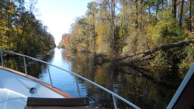
THROUGH THE DISMAL SWAMP
Although we can see the narrow Dismal Swamp Canal on the GPS Chartplotter we still need the spotlight to really see the canal so we do not run aground on either shoreline. Precarious at best so we make our next decision: do we idle up to the lock and anchor or? Lucky us! We spot an empty dock before the lock. We drift over and tie up for the evening. Whew! A long day of learning.
Next day we determine that the Dismal Swamp Deep Creek Lock opens at 830 AM. Should we wait at our dock or go ahead to the entrance of the lock chamber? Our decision becomes easy to make when a sailcat passes us at sunrise headed to the lock. Because the Great Bridge Lock is out of service we assume the Dismal Swamp Route will be crowded and our assumptions are right. Here they come, more boats which were anchored in Portsmouth at Hospital Point.
We hurry along and cruise up to the lock door and anchor, saving our #2 place in line to enter the lock. More boats have the same idea and anchor behind us.
Now that we are in line the lock master asks us to enter first because he has 2 sailcats to position in the lock along with other mono hull boats behind us. We are the lucky ones to get the turbulent water as it enters the lock chamber.
As everyone enters and secures the boats we wait for the 12 foot lift to the level of the Dismal Swamp. As we raise up to the higher than sea level vantage point I see over the doors of the lock and spy a 40 foot DeFever we recognize from Fells Point Baltimore. They spent the night tied to the FREE dock on the other side of the lock. They were waiting for the lock to open so George the lockmaster could hustle down and open the draw bridge. Yes, George does it all: locks, drawbridges and FREE advice if you feed him breakfast muffins.
Joining two other boats ahead of us we start the crawl through the Dismal Swamp. I say crawl for two reasons, the speed limit is NO WAKE and we are afraid to suck up a branch into our props. The Dismal Swamp Route is promoted as having a controlled depth of 6 feet and we draw 4 and 1/2 feet. Lucky we have a keel deeper than the props but why risk it?
We trailed about a half mile behind a trawler with a 4 foot draft and the second sailboat with a 4 and 1/2 foot draft like us. The trawler had a bump or two and reported back to the boats behind. So we fell back a bit further yet we bumped once too….or actually something popped back up to bump us. No harm no foul,… this time!
Add a narrow straight canal, trees hanging over the water, logs in the water and a few tight squeezes in 22 miles then we enter the second and last lock at South Mills. Here we drop eight feet to the Pasquotank River level. The first sailcat seems to be in a hurry so he races out of the lock ahead of us! Go get’um tiger.
LEAD POSITION IS BEST, ISN’T IT?
We continue the follow-the-leader routine and the first trawler reports an occasional obstruction for the rest of us to be aware and the crowd cruises along. Then we see the sailcat veer sharply left, run into the bank and hit a stump! Uh-Oh!! We pull back on our throttle and report to the boats behind to stop and wait while the sailcat gets free. We then see he may have run over the top of a floating log and steered left and ran aground. OOPS.
After our “yellow flag” (think NASCAR at 7knots) delays the race, our slinky inchworm effect re-occurs and all the boats eventually get back in order, once again following the leader. The rest of the day was uneventful, we cleared the Elizabeth City Drawbridge on schedule at 4 pm and cruised on for another hour before anchoring to the west of the river in calm open water. Didja know there is an active BLIMP Base here? Just a few more things you may never see if you stay on the paved roads of the highway.
Brrrrr…LET’S HEAD SOUTH!
Dinner and lights out but not before we check the weather forecast for below freezing temps. We were fooled by NOAA earlier in the trip and were prepared this time! Dawn’s first light and we have the anchor up & deck washed with the hose we did NOT allow to freeze over night. Away we go!
Great crisp clear weather with a slight breeze allows us to avoid the confines of the Alligator Pungo Canal. We can make the open run around Croatan Sound into the Pamlico and enter the “Nice” Neuse River just before dark.
We anchor near Turnagain Bay (ICW St M 170) in calm weather expecting showers overnight which may have the benefit of rinsing off the boat for us? First light is actually no light because it is foggy. We patiently wait for the fog to lift before heading back into the deeper waters of the ICW. But, the fickle weather and fog came back and enveloped us as we neared the entrance to Adams Creek. Another teaching moment as we had to rely on our RADAR to find the buoy and work our way into the channel before the fog lifted. Great!
Cruising past Beaufort and Moorehead City NC, the weather is getting warmer with hints of fog making navigation a challenge. Add to that we remember last year’s Hurricane Sandy disrupted a few things including the sandbars across the ICW. Low tide was fun crossing a few areas including Lockwoods Folley and Shallottes Inlet. Lucky for us we were following a few sailboats and they showed us the way. In fact one showed us where NOT to go because he ran aground. Later we did “find” the bottom with a few soft groundings but never enough to stop the boat. We are fortunate that we have a full keel and the running gear is protected.
As we near the end of the day we decide that even with the full moon and winds we can not locate a suitable place to anchor this big boat. Best decision is to take a marina for the first time this trip at ST 276 Harbor Village Marina (276 Statute Miles from Norfolk).
OK CARL SANDBURG, ENOUGH ALREADY WITH THE FOG!
Morning has us ready to get up and go, but we must check the fog first. Looks good so we head out and just a few minutes later we are socked in. To go back or forward is always a difficult decision so we creep along with the RADAR. We make the next bridge an hour after we planned and finally approach the Wrightsville Beach Bridge which only opens at the top of the hour so it is important to be there on time.
Continuing on through Snows Cut and into the Cape Fear River with a beautiful clear day and calm seas, the tide was in our favor- 13.4 SOG (speed over ground) in a full displacement trawler! The Rock Pile and Myrtle Beach are next and we again decide to take a marina for the night. The Rock Pile was calm and the tide was low slack water but always remember to use the VHF to announce you are entering the Rock Pile area. This narrow rocky channel makes it difficult to meet or overtake a large vessel without someone going aground.
Only 100 miles to our final destination. No fog – WHOO-HOO!! But we are accompanied by plenty of sailboats motoring at 5 knots so we must weave through traffic to overtake them one by one. Taking care to appreciate the extreme low tides we monitor our depth gauge keeping us in the deeper waters as we round curves and cross intersecting creeks and channels. Finally,…a toast to our successful arrival in the Isle of Palms marina just north of Charleston.
When you buy your dreamboat and would like to learn more about below deck systems, navigation, electronics and develop maneuvering skills for docking and anchoring, just ASK CAPTAIN CHRIS!