As presented on the AGLCA BlogTalkRadio Show April 8, 2011
Here’s a quick written review of our radio presentation but if you’d like to listen to the recorded show just scroll down to the END of this article and you can hear the show in its entirety.
Thanks for having us on the AGLCA BlogTalkRadio program. We are so pleased to share our Treasure Coast with all the listeners. After the show if you have any questions we can be reached through AGLCA’s web site as we are Lieutenant sponsors or at www.captainChrisYachtServices.com.
Florida’s Treasure Coast starts just above Palm Beach and continues on until you reach the Space Coast that is home to NASA. The Treasure Coast is named after the Spanish Treasure Fleet sinking off shore in a hurricane or two. This is the famous treasure fleet that got Mel Fisher started in the Treasure Hunting business.
To make this discussion easier to understand we suggest using the Intracoastal Waterway Chartbook from Miami to Norfolk, VA by Kettlewell, The Waterway Guide and of course Skipper Bob’s Guide to Anchoring on the ICW. If you don’t have them handy as you are listening to this then just jot down the Statute Mile and you can reference your notes later when you have your charts in front of you.
These are NOT nautical miles so reset your GPS for measuring distance and if you are concerned about arrival times at bridges or locks. The Statute Mile Markers is seen on your chart as ST M with a magenta slash mark and a number indicating how many miles you are from Norfolk. This is splashed across the magenta line of the ICW every 5 miles. Anchorage guides also use the MM (mile marker) or ST M (Statute Mile) system for reference.
For those of you who have not yet started the LOOP here’s a quick review: The ICW starting point is Norfolk, VA and counts towards Miami. Norfolk is ZERO and Miami is ST M 1090. This system takes into account ALL the zig zags along the route. Think of the Interstate system. We live near I-95 at exit 147, or 147 miles from the beginning of the Interstate 95 in Miami.
For LOOPERS headed north this is a snapshot of our experiences while cruising the Treasure Coast. Remember we’ve lived aboard our boat for 15 years and have cruised this area extensively as we moved north and south with the snowbirds and now while training others in our charter boat SANDY HOOK!
Nuff said, lets go cruising.
Statute Mile Markers:
1018. Palm Beach, a popular port to head towards the Bahamas, West End in Grand Bahama then onto the Abacos. It is ONLY 54 miles to the crystal clear waters of a foreign country with wonderful people and beautiful anchorages. Wait for fair weather to cross the Gulfstream.
1014. North Palm Beach anchorage. Great small cove and can be crowded in bad weather.
1005. Jupiter Inlet. This is the most photographed lighthouse in Florida. The inlet is tricky so ask for local knowledge by radioing TowBoat US or SeaTow. Do not plan to come in this inlet. We ONLY use it to enter the ocean with good weather in daylight. A dredge was working this area in the spring of 2011. Read their day shapes or radio them on channel 13 for passing information.
1000 to 999. Hobe Sound. This is between Jupiter Island and Tequesta on the mainland. Watch for the SLOW or IDLE speed zones to anchor out of channel in deeper 7 & 8 feet of water. Well protected from East and West winds.
993. Peck Lake. Don’t believe the charts as they are not accurate here. This popular anchorage can accommodate boats up to 65 feet but only in the best location. Check with anchorage guides for entrance. South of G19 turn east into the anchorage. Scout around with your depth gauge to find good water for both the anchor and enough swing room. Dinghy ashore to see the Sea Turtles nesting in the spring and summer. This is a state park and the rangers mark off the nests to protect them, giving the baby turtles a fighting chance. Wonderful ocean beach. Only access is by boat so the beach will be quite empty allowing you lots of elbow room for shelling or snorkeling in the surf.
989. St. Lucie Inlet. Frequently in Notice to Mariners as being shoaled. Please consider this an outlet and do not plan to come in without local knowledge. Radio SeaTow or TowBoatUS.
989. Rocky Point. Cruising north on the ICW you will enter “The Crossroads”. This is the intersection where you can cruise in any direction,
– West to the Okeechobee Waterway & Fort Myers on the Gulf of Mexico
– East to the Bahamas
– South to Palm Beach, Miami and the Florida Keys
– North to Norfolk and the Chesapeake Bay.
Use your binoculars to search for the ICW R238. DO NOT get confused with the DIAMOND marking the shoal off Rocky Point. Get the message: Diamonds are Dangerous. Do not wait to get close enough to read the words, Diamonds are Dangerous.
987. Manatee Pocket. Wonderful cove that features a FREE dinghy dock and a long walk to a grocery store. Unfortunately, the West Marine has recently moved up to US Hwy 1 making it too far to walk. Winter 2010 through Spring 2011 there has been a dredge in operation. They should be completed soon but be aware the “pocket” has changed and will soon be better and deeper.
Easter Sunday April 24th, 2011 there will be a Sunrise Service held at Sandsprit Park near the entrance to Manatee Pocket and the OWW, Okeechobee WaterWay.
987. St. Lucie River. During bad weather, if you are not comfortable anchoring in Peck Lake or Manatee Pocket consider heading up the St. Lucie River a mile or two and hide in the lee of the large land bluffs. Great holding and the local boat traffic slows near dark making a safe anchorage for the evening. The traffic starts again the next morning. Stuart is the Sailfish Capitol of the World.
981.4. Jensen Beach Bridge. This is a 65 foot bridge that uses the old section as a fishing pier. This lower bridge helps reduce the fetch just like a breakwater does. Enter the anchorage from the south at R220 and ease northward in the deeper 8 foot water. You may notice the water become a little shallow then it will drop back to the 8 foot mark nearer the shoreline. Leave the same way you entered.
971. This is a wide spot on the ICW. You have a lot of east west room to maneuver if you need to re program your autopilot system.
966. Faber Cove anchorage. Heading east in the Faber Cove channel BEWARE of a sunken 40 foot sailboat east of R4 barley on the southern edge of the marked channel. This wreck is completely underwater at high tide and shows about 6 inches above water at low tide. Faber Cove is a great anchorage, especially all the way in the back between the condos. (since this writing the wreck has been removed HOORAY!)
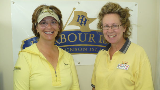
966. Harbour Isle Marina (inside the Condo Complex). This is the home of Sandy Hook, our 44 foot Training Vessel. This marina is great for cruisers wanting a beach walking distance from the marina. The inlet beach is across the street and the ocean beach is a bicycle ride to the east. We are broadcasting from the Marina Manager’s Office today and would like to thank Sarah for offering her landline for the Loopers Radio Broadcast.
966. Fort Pierce City Marina channel. If you have an older chart that channel was closed off after the hurricanes of 2004. The new channel is now closer to the 65 foot bridge. CAUTION, the channel has a “Y” entrance and the tidal current can ease you out of the channel. Crabbing the boat may be required when the tide is running. Radio the City Marina for instructions.
Fort Pierce Highlights:
Every Thursday night BIKE NIGHT downtown. Easy short walk from marina.
Every Saturday morning Farmers Market and Craft Fair in Marina Square.
First Friday night of the month a city party with music and food vendors.
Last Friday night of the month Classic Car show downtown, short walk.
965. West Marine, CVS Pharmacy, PUBLIX Grocery, Dollar General and eyeglass repair an easy 1 1/2 mile walk from Harbortown Marina. FREE loaner bicycles or rental cars available from the dockmaster’s office.
965. Popular anchorage on the ICW in front of Harbortown Marina. We see a lot of boats anchored her but we have always been uncomfortable with the area. Fast boats may wake you and the area has tidal current traveling in both directions during a regular cycle. Did I mention it was shallow here too? We suggest you consider Faber Cove anchorage.
965. Fort Pierce Inlet is an excellent inlet. It is a ship channel and has rock jetties on both north and south banks at the entrance. Channel depth is 35 feet or deeper. When returning from the Bahamas this is a popular entry location because Customs and Immigration is at the small local airport. We suggest you check into a marina and rent a car or taxi to visit the airport 3 miles away. In and Out, no crowds. This is a country airport and we love it.
951.9. VELCRO BEACH. Yep, that’s the nickname for Vero Beach. Once you visit Vero you can’t leave. VELCRO has many cruisers that have purchased homes in Vero because it is a very friendly and popular location. In fact we have a group known as CLODS and we are members! Cruisers Living On Dirt.
Another fantastic feature about Vero Beach is the bus system that can deliver you to the LOOPERS 3 Ws- West Marine, Walgreen’s and Wal-Mart.
951.9. Vero Beach City marina and Mooring Field is located in an oxbow lake that is the former ICW Channel. The mooring balls may have up to 3 boats per ball in HIGH season in this protected area. Marina slips are also available.
Vero Beach Power Squadron and Vero Beach Yacht Club are a short walk.
946.5. Hole in the Wall anchorage. Anchor between Hole in the Wall Island and Pine Island in 8 feet of water. Leave the ICW at R110 and favor mid channel towards Pine Island. This is a popular anchorage for boats clubs to have weekend “raft ups” so you know the water is deep and protected from the faster boats traveling on the ICW.
935.5. Sebastian Inlet. Local Knowledge ONLY.
925. The ICW finally has water deep enough on both sides of the channel. Anchor out of the channel in the evening when faster boats have stopped for the day. No tides or currents because this area is very far from an ocean inlet.
914. Entrance to Banana River at Dragon Point. The dragon is gone. The Banana River has been a popular location to watch shuttle launches but after 9-11 the area now has a security perimeter. Check with the US Coast Guard for details.
885 to 883. This is the NEW popular anchorage for viewing shuttle launches. Because of shoaling leave the ICW channel and enter the deeper water area north of the Addison Point Bridge. Choose an anchorage depending on wind direction. To locate the shuttle launch pad look for the large building that looks like a condo or apartment building. You may notice the NASA logo on the south side. This is the VAB- Vehicle Assembly Building. The launch pad is to the north next to a water tower. ONLY TWO shuttle launches left, be a part of history and watch them lift off on April 29th and June 28th.
878. Titusville Bridge. The old drawbridge has been replaced with a 65 foot bridge.
869. Haulover Canal Bridge. This area is a wildlife refuge. SLOW and IDLE Zones here and take your time. You can see manatees, dolphins and other wildlife frolicking here.
Hope you enjoyed our 149 mile cruise on the Treasure Coast, traveling from the Palm Beaches to the Space Coast.
See you on the water,
Captains Chris & Alyse Caldwell – 772-205-1859
www.CaptainChrisYachtServices.com
Building Cruising Confidence as a Couple
Living the Dream