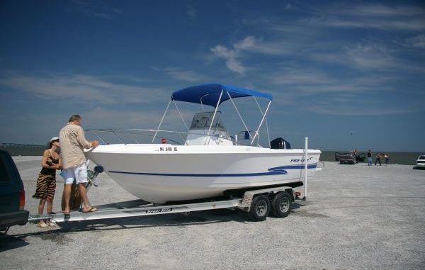
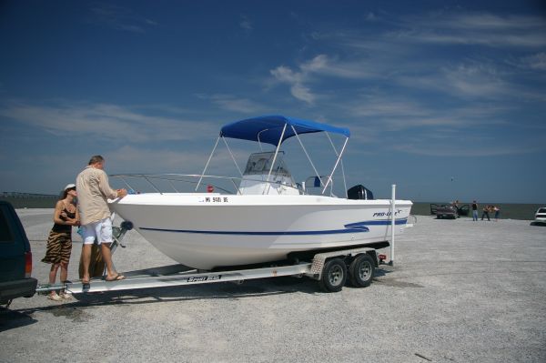
First boat EVER!
This couple lives in Bay St. Louis Mississippi and wanted a boat that could take them 10 miles out to Cat Island and back regardless of the weather. A 20 foot Proline Outboard Boat fits the requirements. It has high freeboard, a powerful 150 HP Mercury Outboard and a nice vee to slice the seas when running into the weather.
We started with the basics: vessel inspection, equipment inventory and automobile trailer launching procedures. As we drove to the boat ramp I saw a lot of loose gravel on the ramp making traction difficult to pull the boat out of the water. I suggested carrying a garden rake to pull the gravel away to improve traction.
As we launched the boat (yes the plug was in) we reviewed starting procedures then went out into the Mississippi Sound. Lots of practice using the marine radio and GPS Chart Plotter, noting the depth gauge and monitoring water bottom curves and submerged objects. Lunchtime snuck up on us so we anchored to stop and enjoy some New Orleans Po Boys. Weighing anchor, we used the GPS to retrace our course home and put the boat back on the trailer. As expected the loose gravel on the ramp gave us a fit pulling the boat out but we managed. After we pulled the boat home we fresh water flushed the engine and washed the boat.
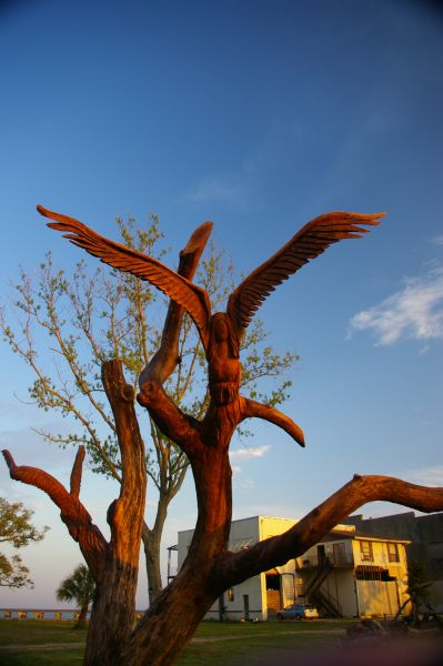
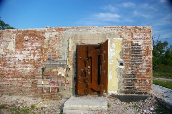
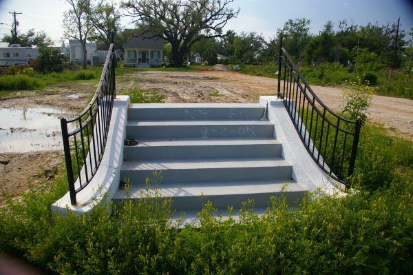
This was a beautiful day in Late April- warm weather, calm seas and a nostalgic tour of the Mississippi Gulf Coast 3 years after Hurricane Katrina. Please look at the old Oak Tree with the Angels carved into the branches. This tree saved 3 people that were washed out of their collapsing home in the 30 foot tidal surge.They clung in the branches for hours until the storm subsided. Their home is gone and the tree is now dead but the carving will endure time. Also check out the steps that used to go to a house and the bank vault door that is rusted open: the bank building is gone.
A navigation note. The two bridges across Bay St. Louis were destroyed. During demolition and rebuilding the bridge the old concrete rubble was used to make a fish haven about 2 miles south of the bridges in the sound. Beware, this rock pile is in a crescent and above water but NOT on navigation charts, paper or electronic. It is marked on the west side with two lighted nun day markers #2 & #4.